
Downloads
Walking
Looking for a good country walk?
With 820km of public footpaths and bridleways, there are endless options for walking in Nidderdale National Landscape.
No matter what type of walk or hike your looking for, we’ve got you covered:
- long distance walking trails that cut across the Yorkshire Dales countryside
- short walking routes, including family friendly trails
- information on open access land if you want to venture out and do some serious hiking or hill walking
So download a free guide, grab your boots and have a fantastic day out walking in the Yorkshire Dales!
- Please note, North Yorkshire Council is responsible for maintained public rights of way in Nidderdale National Landscape, including making sure paths are free from obstructions, installing and maintaining signage and waymarkers, and repairing stiles and gates. If you come across issues affecting rights of way, please report it directly to the Council using the form on their website.
Walking routes
Our hiking and walking route suggestions below have free, downloadable maps with route information and points of interest along the walk.
Pateley Bridge, Bewerley and central area
-
Bewerley Tree Trail
A short walking route for all the family taking in the lovely village of Bewerley through to Fishpond Wood. This walking route is one of our most popular walks for families and the more casual walker.
Nearest village: Bewerley Length: 1.25 miles (2km) Time (approx): 1 hour Difficulty: easy
Download our free printable A4 route guide -
Curlew Trail
This family-friendly trail follows a mix of footpaths and quiet lanes. Starting along the River Nidd it heads up through woodland to heather moorland, taking in the magnificent views and abundant wildlife.
Nearest village: Pateley Bridge Length: 3 miles (4.8km) Time (approx): 1.5 hours Difficulty: moderate -
Pateley Bridge Circular Trail
This route takes in the amazing geological features of Brimham Rocks and passes through woodland and rolling fields, giving fantastic views across the valley.
Nearest town: Pateley Bridge Length: 9 miles (14km) Time (approx): 4-5 hours Difficulty: moderate -
Pateley Bridge Heritage Trails
Discover more about the town’s fascinating history, follow the inner trail as it winds its way through the historic streets.
Nearest town: Pateley Bridge Length: Inner trail 1 mile / Outer trail 2.5 miles
Time (approx): Inner trail 1 hour / Outer trail 1.5 hours Difficulty: easy/moderate -
Victorian Gardens of Pateley Bridge Trail
Take a walking tour around Pateley Bridge and see some of the fabulous historic houses and gardens.
Nearest town: Pateley Bridge Length: 3.75 miles (6km) or 4.75 miles (7.5km) Time (approx): 2-3 hours Difficulty: moderate -
Yorke’s of Bewerley Trail
This walk takes you around what were once the extensive gardens and grounds surrounding Bewerley Hall which, until it was demolished in the 1920s, was the home of the influential Yorke family. The designed landscape, developed in the 18th to 20th centuries, included parkland, pleasure gardens, woodlands, ponds, walled kitchen gardens and a folly.
Nearest village: Bewerley, Pateley Bridge Length: 5 miles (8.5km) Time (approx): 3-3.5 hours
Difficulty: moderate -
Fishpond Wood Trail
Along this route you can take a walk through the historic village of Bewerley and enjoy the serenity of Fishpond Wood.
Nearest village: Bewerley Length: 2 miles (3km) Time (approx): 1-1.5 hours Difficulty: easy / moderateDownload our free printable A4 route guide / An audio walk through the wood, guided by owner Dr Peter Brambleby, is available on the Upper Nidderdale Landscape Partnership website
-
Ladies Riggs and Ashfoldside Trail
Along this route you will walk through the abandoned industrial landscape around Prosperous Smelt Mill, enjoy the secluded beauty of Ashfoldside Beck and take in the atmospheric Ladies Riggs and Bale Bank.
Nearest town: Pateley Bridge Length: 5.5 miles (8.8km) Time (approx): 2-3 hours Difficulty: moderate -
Scot Gate Ash Trail
Along this route you can enjoy spectacular views across Nidderdale, take a short detour to the ruins of the 14th century St Mary’s Church, stroll up Pateley Bridge’s historic High Street and view the atmospheric remains of Scotgate Ash Quarry.
Nearest town: Pateley Bridge Length: 4 miles (6.4km) Time (approx): 2-3 hours Difficulty: moderate -
Nought Moor Trail
Along this route you can enjoy a range of different settings, from the quiet serenity of the woods at Middle Tongue Bank to the heather moorland and blanket bog of Nought Moor, and take in spectacular views across Guisecliffe and Yorke’s Folly.
Nearest village: Bewerley Length: 4.7 miles (7.5km) Time (approx): 2-3 hours Difficulty: moderate -
Wath Trail
Along this route you can enjoy a range of different settings, from the wetlands of Nidd Marsh to the tranquillity of Spring Wood Top, take in serene views across Gouthwaite Reservoir nature reserve and see historic buildings such as the nineteenth century Dutch hay barn at Spring Wood Top farm.
Nearest village: Wath / Pateley Bridge Length: 1.5 miles (2.4km) Time (approx): 1-2 hours Difficulty: easy
Upper Nidderdale
-
Greenhow Geology Trail
Take a journey back in time from the present day, to the Ice Age, then to tropical conditions 300-350 million years ago where you can discover fossils from the tropical seas and forests.
Nearest village: Greenhow Length: 3.5 miles (5km) Time (approx): 2-3 hours Difficulty: moderate
-
Prosperous Lead Mine Trail
A choice of two circular routes exploring the industrial heritage of Prosperous Lead Mine and the surrounding area.
Nearest village/town: Pateley Bridge / Greenhow Length: From Pateley Bridge 5.8 miles (9.3km) / from Greenhow 4.6 miles (7.5km) Time (approx): From Pateley Bridge 3-4 hours / from Greenhow 2-3 hours Difficulty: moderate -
Scar House Reservoir Trail
This route enables you to enjoy the remote beauty of Scar House and Angram reservoirs, appreciate the labours of the men and women who lived and worked here during the reservoir’s construction, and see how innovative approaches to farming are helping vulnerable species and habitats to thrive.
Nearest village:Lofthouse / Middlesmoor Length: 4.3 miles (7km) Time (approx): 2-3 hours
Difficulty: moderate -
Stean Trail
Along this route you will enjoy the tranquillity and natural beauty of Cliff Woods, see dramatic limestone rocks and cliffs in How Stean Gorge and walk through traditional hay meadows on Low Riggs Farm.
Nearest village: Lofthouse / Middlesmoor Length: 4.5 miles (7.3km) Time (approx): 2-3 hours
Difficulty: moderate -
Toft Gate Trail
Along this route you will experience a range of different settings, from the industrial heritage of Toft Gate Lime Kiln to Coldstones Cut, a monumental piece of public art with spectacular views, and hear the calls of upland birds on the high pastures of Toft Gate Farm.
Nearest village: Greenhow / Pateley Bridge Length: 5.5 miles (8.8km) Time (approx): 2-2.5 hours Difficulty: moderate -
Woodale Trail
This route enables you to enjoy spectacular panoramic views of Scar House Reservoir, Great Whernside and the Upper Nidderdale moorlands, and walk along the Nidd’s unique dry river bed as the watercourse disappears into limestone caverns deep underground before re-surfacing downstream.
Nearest village: Lofthouse / Middlesmoor Length: 6.5 miles (10km) Time (approx): 3-4 hours
Difficulty: moderate / hard
Lower Nidderdale
-
Hartwith Heritage Walk
This walk explores the long history of human activity in this area of Lower Nidderdale and highlights the clues along the way.
Nearest village: Summerbridge , Low Laithe Length: 7.5 miles (12km) Time (approx): 3-4 hours
Difficulty: moderate
Download our free printable A4 route guide -
Kingfisher Trail
In the heart of Nidderdale National Landscape, the Kingfisher Trail is a circular walk, starting and finishing in the beautiful village of Darley, following the River Nidd, through woodlands and meadows, abundant in wildlife.
Nearest village: Darley Length: 3 miles (4.8km) Time (approx.): 1.5 hours Difficulty: moderate -
Packhorse Trail
A circular route taking in Darley and Thornthwaite, through beautiful wild flower meadows and ancient woodland, with some unusual historical features.
Nearest village: Darley Length: 4.5 miles (7.2km) Time (approx.): 2-3 hours Difficulty: moderate
The Washburn Valley and southern area
-
Blubberhouses Tree Trail
A riverside walking route full of interest with a variety of tree species, lots of wildlife and glimpses of industrial heritage. This walking trail is hugely popular and gives walkers the opportunity to experience the diverse wildlife that calls Nidderdale home.
Nearest village: Blubberhouses Length: 3 miles (5km) Time (approx): 1-2 hours Difficulty: moderate
Mashamshire and northern area
-
Jervaulx Abbey to Thornton Steward Trail
Starting and finishing at the fascinating ruins of Jervaulx Abbey, this country walk takes you through stunning parkland, over lush pasture fields and through the historic village of Thornton Steward.
Nearest town: Masham Length: 7 miles (11km) Time (approx): 3-4 hours Difficulty: moderate -
WW1 Heritage Trail
This quiet dale to the north east of Nidderdale National Landscape has been the focus of a three year First World War Centenary project: Nidderdale National Landscape and the First World War: Leeds Pals, POWs and the Home Front. This heritage trail is a result of the project research and it tells the story of Colsterdale in the First World War.
Nearest village: Healey, Masham Length: 3.3 miles (5.3km) Time (approx): 1-2 hours Difficulty: moderate
Ripon and eastern area
-
Aislabie Walk
A journey through the picturesque and designed landscapes of Studley Royal, Laver Banks and Hackfall.
Nearest village: Studley Roger Length: Short 7.5 miles (12 km) / Medium 11.5 miles (18.5km) /
Long 17.5 miles (28km) Time (approx): Short 3 hours / Medium 6 hours / Long 8-9 hours Difficulty: moderate -
Crackpots Mosaic Trail
An intriguing walking trail around part of Dallowgill, marked with 22 mosaics showing local scenes of flora and fauna.
Nearest village: Kirkby Malzeard Length: 7 miles (11km) Time (approx): 4 hours Difficulty: moderate -
Fountains Abbey to Markenfield Hall Trail
A walking route that links two important medieval sites near Ripon in North Yorkshire – Fountains Abbey and Markenfield Hall. In monastic times their lands adjoined.
Nearest town: Ripon Length: 6.5 miles (10.5km) Time (approx): 3-4 hours Difficulty: moderate
** Please note that the tourism information on this website is designed to provide an overview of opportunities in the area. The Nidderdale National Landscape team do not have the facilities or resources to deal with individual tourism enquiries and these should be directed to the tourist information office at Nidderdale Plus or one of the other local Tourist Information Centres.
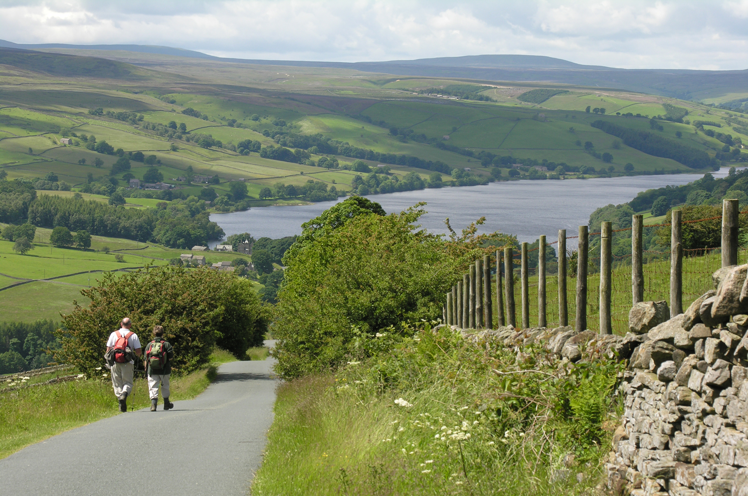
Main image: Walkers above Scar House Reservoir courtesy of Michael Bell/Ripon Photographic Society. Image above: Walkers overlooking Gouthwaite Reservoir courtesy of Janina Holubecki.